First joint picture of Greenland Ice Sheet melting, ESA

Multimedia
- Yesterday, 21:28
INA - SOURCES
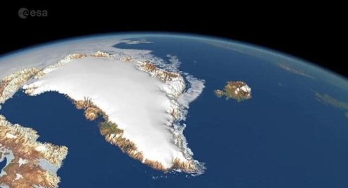
Global warming is driving the rapid melting of the Greenland Ice Sheet, contributing to global sea level rise and disrupting weather patterns worldwide.
Because of this, precise measurements of its changing shape are of critical importance for adapting to climate change.
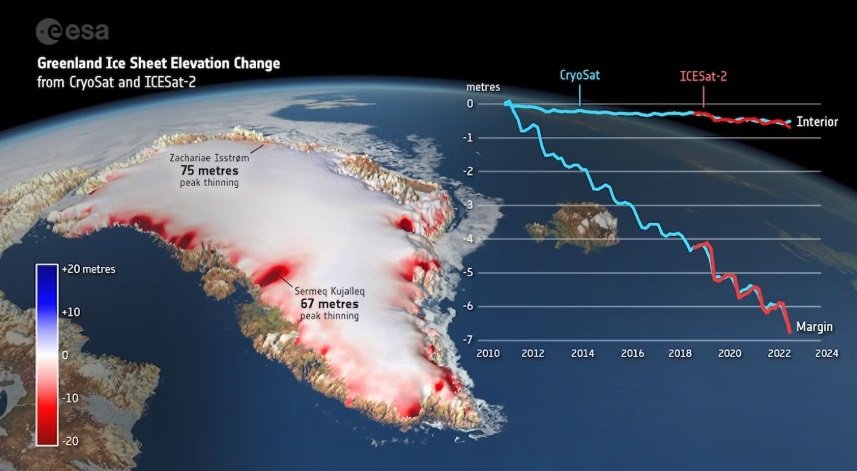
Now, scientists have delivered the first measurements of the Greenland Ice Sheet’s changing shape using data from ESA's CryoSat and NASA's ICESat-2 ice missions.

Although both satellites carry altimeters as their primary sensor, they make use of different technologies to collect their measurements. CryoSat uses a radar system to determine Earth’s surface height, while ICESat-2 uses a laser system for the same task.
Although radar signals can pass through clouds, they also penetrate the ice sheet surface and have to be adjusted to compensate for this effect. Laser signals, on the other hand, reflect from the actual surface but cannot record when clouds are present. The missions are therefore highly complementary, and combining their measurements has been a holy grail for polar science.
A new study from scientists at the UK Centre for Polar Observation and Modelling (CPOM) and published today in Geophysical Research Letters, shows that CryoSat and ICESat-2 measurements of Greenland Ice Sheet elevation change agree to within 3% of the changes taking place.
This confirms that both satellites can be combined to produce a more reliable estimate of ice loss than either could achieve alone. It also means that if one mission were to fail, the other could be relied upon to maintain our record of polar ice change.
Between 2010 and 2023, the Greenland Ice Sheet thinned by 1.2 m on average. However, much larger changes occurred across the ice sheet’s ablation zone where summer melting exceeds winter snowfall; there, the average thinning amounted to 6.4 m.
China Says It 'Firmly Opposes' US Military Aid To Taiwan
- International
- 07:36
First joint picture of Greenland Ice Sheet melting, ESA
- Multimedia
- 09:28
US Central Command: We killed ISIS terrorist leader Abu Yusuf in Syria
- International
- 24/12/20
Liverpool compete with Real Madrid to sign Olympique Lyonnais star
- Security
- 24/12/19
ISC, ADX discuss Strengthening Economic Ties
- Economy
- 24/12/16
Iraq assumes presidency of Arab Investment Company’s Executive Board
- Economy
- 24/12/17


